

Bloomin' Metric®:
The Routes
We have four incredible routes with your choice of navigation aids to direct you as you cycle along the beautiful Connecticut shoreline and through our classic New England countryside – all featured in this popular bike tour.
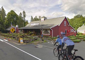
Choose your route knowing you can switch routes during the early portions of your ride as the routes overlap for a few miles. Our routes have extensive ride marshal and police support to keep everything running smoothly and safely.
Navigation Information and Aids
You have four options for navigating the routes:
• On all routes we have road signs for directions at all turns, route splits, food stops and for caution areas.
• Free Electronic Navigation (you download and install prior to the event)
• Paper Cue Sheets/Maps (you download and print prior to the event; printed copies also available day of the event at check-in).
• Ride Leader Guided Rides (available on 15-mile and 25-mile routes)
The routes will be available about a two weeks prior to the ride and registrants will be sent an Invite email with links to access the Free Electronic Navigation and the Paper Cue Sheets/Maps. You will also get a repeat invite one week before and the day before, especially if there should be any updates. Choose the route that suits best for you. If you are unsure of what route you might ride, download the navigation for more than one route so you are prepared. Be sure to review your navigation before you come to the Park to familiarize yourself with your route(s). Ensure your electronic navigation works properly and/or your cue sheets/maps are properly attached to your handlebars (note: available at the Park are printed cue sheets/maps and clips that help attach cue sheets to most handlebars). There will be limited tech support to help troubleshoot electronic navigation issues after you have checked in.
25 km
SHORTEST ROUTE
SUGGESTED START TIME:
9:30 AM – 10:00 AM
OR
9:00 AM: MEET WITH RIDE LEADER FOR A GUIDED RIDE This route was designed specifically with the new or less experienced rider in mind. Optionally, you can join a group ride led by one of our experienced ride leaders who keeps the group together in a tour-like fashion, guiding the riders along the course. This may be a perfect opportunity to get comfortable with bicycling as you are shepherded along an inviting route at an easy pace with several stops.
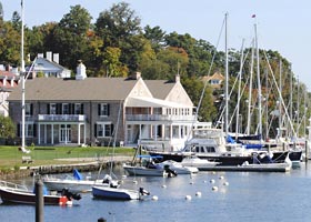
This route offers fairly easy terrain as it travels from the shoreline of Westport, with beautiful views of Long Island Sound, into Southport Harbor and turning slightly north of Route 1 in Fairfield. As you head back west into Westport you'll pass by old farmlands and a hunt club.
Arrive at the park early to allow yourself time to park, gather your bike, helmet, water bottle, etc. and then check-in. If you choose to join a group ride, follow signs to the Meeting Area. Meeting time is 9:00 am. For details, click here. Watch for your Invite Link 2 weeks, 1 week and a day before the Event to navigate this route.
9:30 AM – 10:00 AM
OR
9:00 AM: MEET WITH RIDE LEADER FOR A GUIDED RIDE This route was designed specifically with the new or less experienced rider in mind. Optionally, you can join a group ride led by one of our experienced ride leaders who keeps the group together in a tour-like fashion, guiding the riders along the course. This may be a perfect opportunity to get comfortable with bicycling as you are shepherded along an inviting route at an easy pace with several stops.
This route offers fairly easy terrain as it travels from the shoreline of Westport, with beautiful views of Long Island Sound, into Southport Harbor and turning slightly north of Route 1 in Fairfield. As you head back west into Westport you'll pass by old farmlands and a hunt club.
Arrive at the park early to allow yourself time to park, gather your bike, helmet, water bottle, etc. and then check-in. If you choose to join a group ride, follow signs to the Meeting Area. Meeting time is 9:00 am. For details, click here. Watch for your Invite Link 2 weeks, 1 week and a day before the Event to navigate this route.

40 km

MEDIUM ROUTE
SUGGESTED START TIME:
8:30 AM – 9:30 AM
OR
9:00 AM: MEET WITH RIDE LEADER FOR A GUIDED RIDE This route travels slightly more inland than the shortest route but still shares views of Long Island Sound in Westport. As you continue north into Fairfield, you begin to ascend Greenfield Hill, known for it blooming dogwood trees, for which the Bloomin' Metric® was named. Optionally, you can join a group ride led by one of our experienced ride leaders who guides the riders along the course. Remember, this is not a race. It's a bike tour with plenty to see, so take your time and enjoy the scenery.
This route passes through two towns – Westport and Fairfield that offer beautiful shoreline and inland views. The terrain is a combination of rolling with some hills and plenty of flat sections. The course will travel just north of the Merritt Parkway passing through horse farm country and to the one food stop on this route before you make your way back into Westport.
If you choose to join a group ride, follow signs to the Meeting Area. Meeting time is 9:00 am. For details, click here. Watch for your Invite Link 2 weeks, 1 week and a day before the Event to navigate this route.

75 km
MEDIUM LONG ROUTE
SUGGESTED START TIME:
7:30 AM – 9:00 AM For the more ambitious rider or those who want more of a challenge, this route offers all kinds of terrain from flat to rolling hills to challenging climbs. The course travels through five towns passing along the shore in Westport, heading up to the rolling hills of Fairfield and around the reservoirs in Easton, Redding and Weston.
From a scenic point of view, the course features crashing waterfalls and classically quiet, narrow, totally tree-covered country roads. The route profile slowly builds to a crescendo with a climb to the top of the reservoir in Redding before descending down to Weston.
There are two food stops along the route with two specifically placed for the 75-kilometer riders. The extra stop is placed to service the 100-kilometer riders who share their return route with you. Once reentering Westport there will be some fast downhills and a few rolling hills before flattening out on the return to the park. Watch for your Invite Link 2 weeks, 1 week and a day before the Event to navigate this route.

100 km

LONGEST ROUTE
SUGGESTED START TIME:
7:00 AM – 7:30 AM For seasoned cyclists or those who want more to stay on the bike for a longer ride, this course features flat to hilly terrain and everything in between. This route travels through seven towns and follows all of the 75-kilometer route with an added 25-kilometer loop that truly defines the word bucolic.
The upper loop enters Newtown and finds its way through narrow, winding roads, past lily ponds and crashing waterfalls within the Poverty Hollow section of the course. As the route circles around you will find yourself in farm country with plenty of horses, cows, sheep and goats watching you pass by.
There are three food stops along this route to make sure you are completely refueled for the remainder of the ride. After the rollercoaster ride around the Saugatuck Reservoir, you'll flatten out somewhat as you head down toward the shore and into the park at Sherwood Island. Watch for your Invite Link 2 weeks, 1 week and a day before the Event to navigate this route.
